WaterMap N-Africa is a satellite-based monitoring platform, developed by the Aerospace Information Research Institute, Chinese Academy of Sciences (AIR-CAS) with support from The Alliance of International Science Organizations (ANSO), to tackle severe water scarcity and promote sustainable agricultural water management in Egypt, Morocco, Tunisia, Libya, and Algeria.
By integrating multi-source remote sensing data and the ETMonitor model, WaterMap N-Africa delivers three core functions:
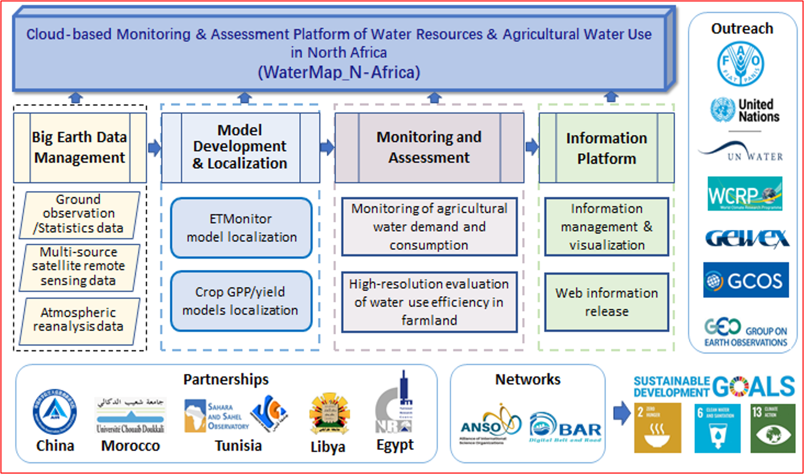
System data provided by AIRCAS EOwater Team includes: